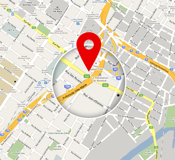
The correct location of Prestige Crystal Lawns is IVC Road, North Bangalore, Karnataka 562110. Located in the northern part of Bangalore, the project connects to all major parts of Bangalore through SH 104 and New Airport Road.
It is important to choose a plot in a location that will give high ROI and allow you to unwind after a busy day at work as your choices. The growing number of IT Parks makes Prestige Crystal Lawns a desirable property to invest in for end-users.

The exact address of Prestige Crystal Lawns is IVC Rd, North Bangalore, Karnataka 562110. The project address is in the northern area of the city, and it has easy access to all major areas through the metro and the bus.

Prestige Crystal Lawns Connectivity is excellent with hassle-free access to all areas of Bangalore through rail, road, metro, and air. The project is connected well to other areas through roads that include SH 104, NH 207, Bellary Road, NH 44, and Tumkur Road. The upcoming Phase 2 Blue Line of the metro is coming just near the project location, and it will give good metro access to reach all areas easily.

Prestige Crystal Lawns, constructed on IVC Road, offers convenient access to many national and state highways. The project site is located near a big bus stop. Using BMTC buses is a cost-effective option that contributes to environmental preservation.
Nearby BMTC bus stops
- Ilathore Cross Bus Stop – 820 m

Prestige Crystal Lawns has straight access to the upcoming Blue Line of the Metro. The Doddajala metro station is nearby which will give an improved metro network through IVC Road when it is completed.
Closest Metro Station
- Doddajala metro station – 5.8 km

The project's proximity to Bangalore's prime railway stations makes access to other cities easy. The nearest railway station can be reached through NH 44 easily in 10 mins.
- Devanahalli Railway Station – 6.2 km

Residents of Prestige Crystal Lawns can easily reach the Kempegowda Airport by taking NH-44. The airport is only 15 mins away through NH 44.
- Kempegowda International Airport – 12.9 km

Hennur Bamboo Forest spans over 100 hectares, and it has towering bamboo groves. It has cycling tracks, trail runs, and nature walk areas, which give a peaceful break from busy city life. The annual Hennur Bamboo Ultra, which features looping trails of 10 km for various races, is the best one to watch here.

Nandi Hills was established by the Ganga dynasty, and it is a very small hill station. It is open from 6 AM in the morning to 6 PM for visitors. Entry is free for pedestrians, and for vehicles it is Rs. 20 to Rs. 50. It is the best spot for nature lovers and for trekking lovers.

Nadaprabhu Statue is the latest milestone in Bangalore, which is the statue of the founder of the city. The statue was opened to the public in the year 2022, and it is made of bronze. It was opened to mark the 510th birthday of the founder. The statue measures about 108 feet tall, and it is noted in "World Book of Records."

Jakkur Lake spans over an area of 160 acres, and it is famous for the big walking trail of 4 km. It is perfect for doing exercise & enjoying serene views. The speciality is a 10 million litres/day Sewage Treatment Plant that treats wastewater before it enters the lake. It is open to the public from 6:00 to 9:00 AM & from 4:00 to 7:00 PM.

Devanahalli Fort was built as a mud fort in 1501 by Malla Byre Gowda. It spans over 20 acres, and there are 12 semi-circular bastions with gun points. The fort is open for 24 hours, with free entry, and camera usage is also permitted. The main gates are of ornate carvings here, and it is the best place that signifies history.

IVC Road is an arterial route that is a vital link between the Bangalore airport and the city, and enables the smooth movement of passengers and goods. It connects with all key areas like Yelahanka, Hebbal, and Kempegowda Airport. The road plays a key role in the expansion of North Bangalore, and there are infrastructure improvements and commercial spaces in the area.
IVC Road connectivity is excellent, as it has major roads that link to all the key areas in the city. BMTC buses are available 24/7 to travel to all needed areas. The ongoing metro extension promises a good metro network.
IVC Road has a direct connection to Kempegowda Airport, and it connects with Bellary Road. The road also connects to ORR, facilitating travel to areas like Hebbal and Whitefield, making it convenient for travellers moving from the airport to other areas of the city.
- Tindlu Road
- Nandi Hills Road
- ORR
- NH 44
- SH 104
- NH 75
- NH 207
- Tumkur Road
- Airport Road
Phase 2A of the Metro towards Kempegowda Airport is a key project that will improve the IVC Road connectivity. The proposed airport metro line will link Nagavara to Kempegowda Airport.
The closest airport to the IVC Road is the Kempegowda Airport, which can be simply reached through NH 44. The location has a direct route that will bypass the city’s traffic and give a quick route to the airport.
- Akash Multispeciality – 13.6 km
- Aster CMI Hospital – 22.7 km
- Cytecare Hospital – 16.7 km
- Columbia Asia Hospital – 24.5 km
- New Manasa Hospital – 6.6 km
- North Bangalore Hospital – 11.3 km
- Bangalore Baptist Hospital -22.6 km
- Omega Multispeciality Hospital – 19.6 km
- Stonehill International School – 12.6 km
- Chrysalis High School - 11.9 km
- Canadian International School – 11.9 km
- Delhi Public School – 12.7 km
- Sterling English School – 13.7 km
- Vidyashilp School – 12.5 km
- Ryan School – 13.6 km
- Esteem Mall – 24.9 kms
- D-Mart – 15.6 km
- RMZ Mall – 21.8 km
- Decathlon – 7.6 km
- Phoenix Mall of Asia – 21.6 km
- Ecopolis – 11.6 km
- North Gate – 12.5 km
- IFCI Financial City – 14.6 km
- Prestige Cloud Tech Park – 5.3 km
- Manyata Tech Park – 21.6 km
- Karle SEZ – 22.5 km
- ITC Factory – 8.2 km
- Devanahalli Business Park – 9.9 km
- Bhartiya City – 21.3 km
- Kirloskar Business Park – 20.2 km
- KIADB IT Tech Park – 15.7 km
- Devanahalli – 6.4 km
- Yelahanka – 12.8 km
- Hebbal – 26.9 km
FAQS
The project is located on IVC Road, North of Bangalore.
The airport is just 12.9 km away, and it can be reached through NH44 in just 15 minutes.
Major Roads and highways that connect IVC Road are Nandi Hills Road, NH 75, ORR, NH 44, and NH 207.
Yes, the project is a good location to stay with family as it has a lot of schools, colleges, and shopping areas nearby.
As IVC Road is growing at a fast rate now, investing in plots now is the best choice as it has potential for high returns later.
| Call | Enquiry |
 Whatsapp Whatsapp
|